David777
Well-known Member
- Location
- Silicon Valley
Hello folks. Do you have the free program Google Earth loaded on your desktop or laptop PC? Arguably one of the most useful and important programs in this Internet era though note using such on a smartphone is limited and awkward. And am quite aware many folks don't even know what it is or why it is so valuable for almost everyone. I use it a great deal, especially for evaluating places I will travel or visit. A most excellent way to explore landscapes of the whole planet from one's couch.
https://en.wikipedia.org/wiki/Google_Earth
snippet:
Google Earth is a computer program that renders a 3D representation of Earth based primarily on satellite imagery. The program maps the Earth by superimposing satellite images, aerial photography, and GIS data onto a 3D globe, allowing users to see cities and landscapes from various angles. Users can explore the globe by entering addresses and coordinates, or by using a keyboard or mouse. The program can also be downloaded on a smartphone or tablet, using a touch screen or stylus to navigate... Google Earth is able to show various kinds of images overlaid on the surface of the earth and is also a Web Map Service client. In 2019, Google has revealed that Google Earth now covers more than 97 percent of the world, and has captured 10 million miles of Street View imagery.
Noticed Google now has an experimental version live for free on the web though with limited features. May take a bit of time to load. Here is a view of Fort Myers Florida, now in the direct path of hurricane Ian:
https://earth.google.com/web/@26.43227004,-81.9252515,-2.90973744a,18160.12600066d,35y,0h,0t,0r
Use your computer mouse to "fly" around at different elevations, zoom in and out, and tilt views. Here is San Francisco from above the Bay Bridge:
https://earth.google.com/web/@37.78...826.81072839d,35y,-87.2210344h,76.7859188t,0r
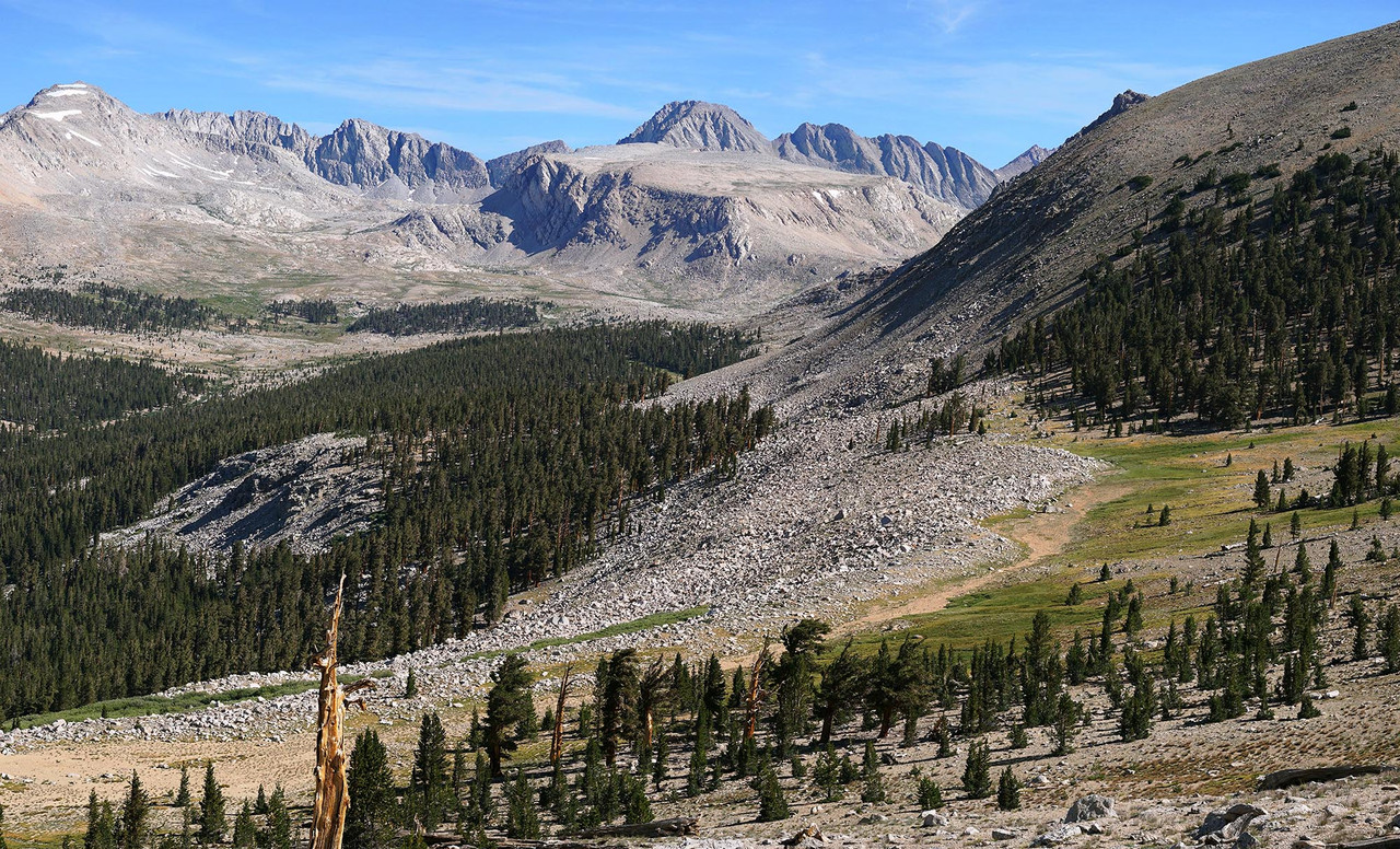
And here a place I'll likely backpack into next summer:
https://earth.google.com/web/@37.49...63.74350881d,35y,52.45274892h,55.69721196t,0r
https://en.wikipedia.org/wiki/Google_Earth
snippet:
Google Earth is a computer program that renders a 3D representation of Earth based primarily on satellite imagery. The program maps the Earth by superimposing satellite images, aerial photography, and GIS data onto a 3D globe, allowing users to see cities and landscapes from various angles. Users can explore the globe by entering addresses and coordinates, or by using a keyboard or mouse. The program can also be downloaded on a smartphone or tablet, using a touch screen or stylus to navigate... Google Earth is able to show various kinds of images overlaid on the surface of the earth and is also a Web Map Service client. In 2019, Google has revealed that Google Earth now covers more than 97 percent of the world, and has captured 10 million miles of Street View imagery.
Noticed Google now has an experimental version live for free on the web though with limited features. May take a bit of time to load. Here is a view of Fort Myers Florida, now in the direct path of hurricane Ian:
https://earth.google.com/web/@26.43227004,-81.9252515,-2.90973744a,18160.12600066d,35y,0h,0t,0r
Use your computer mouse to "fly" around at different elevations, zoom in and out, and tilt views. Here is San Francisco from above the Bay Bridge:
https://earth.google.com/web/@37.78...826.81072839d,35y,-87.2210344h,76.7859188t,0r
And here a place I'll likely backpack into next summer:
https://earth.google.com/web/@37.49...63.74350881d,35y,52.45274892h,55.69721196t,0r
Last edited: