wildfire evacuations

courtesy kulr tv

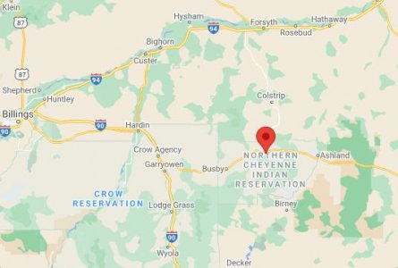
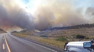
LAME DEER — A wildfire burning in southeastern Montana has jumped to at least 200,000 acres forcing the town of Lame Deer to be evacuated.

The Richard Spring fire started just three days ago and has shut down several highways in the region.

Additionally, the communities of Ashland, Colstrip, and Lame Deer are currently threatened and evacuations are in place.

The Montana Red Cross has opened an emergency shelter in Busby.

Crow Nation News
*** ATTENTION***

Due to the Current Evacuations in Lamedeer & Ashland, Chairman Frank Whiteclay is opening up the Multi-Purpose Building to All Northern Cheyenne Evacuees! Red Cross is on Site, with Beds and Supplies! Let Us Continue to Pray for Our Brothers & Sisters of the Northern Cheyenne!
lamedeer.JPG


richard_spring_fire.jpg
 

@cdestroyer Are you close to this area. With your breathing problems, this is very serious even if you are just in the area of spreading smoke. Be safe.
 
Despite their size I always feel it is nearly futile watching planes fly over fires dumping retardant on the flames. Might as well spit out the windows.
 
this fire is now under control due to the efforts of so many who worked hard: info provided by inciweb.

At 10:00 pm on August 21, Northern Rockies Team 3 turned command of Richard Spring fire back to the local unit. The Lame Deer fire was turned back on August 20.

The Richard Spring Fire was identified on August 8, 2021 about 10 miles southwest of Colstrip, MT. Since then, it has burned along the Tongue River and has threatened multiple communities and infrastructure within the area. Prior to the cooler temperatures, fire behavior was extreme with wind driven runs and is burning in mainly brush, short grass, and timber.

The Lame Deer fire was identified on August 10, 2021 and is located approximately 5 miles NW of Lame Deer, MT. The cause of both fires was coal seams.


Rosebud County Fire Warden and Rosebud County Sheriff have downgraded the evacuation status for the community of Ashland, including the Ashland Divide, Rabbit Town, North Tongue River Road, and the St. Labre Indian Academy Campus, from Level 3 “Go Now” stage to a Level 1 “Be Ready” stage.


The Northern Cheyenne Disaster & Emergency Services have downgraded the evacuation status for the community of Lame Deer, Muddy Cluster, and Rosebud Cut Across from Level 3 “Go Now” to Level 2 “Set” stage for all those who do not have medical conditions. Pre-evacuation notices remain in effect for Rosebud Creek from Greenleaf Creek to Cherry Creek and the Lame Deer Divide Road located on the Northern Cheyenne Reservation south of Lame Deer.


Residents should continue to check Rosebud County Sheriff’s and DES Facebook pages, Northern Cheyenne Disaster & Emergency Services Facebook page, as well as the Richard Spring InciWeb page, as evacuation and road closure status are being evaluated frequently and could change rapidly.
 
These Western wildfires are putting a huge amount of pollutants into the air. Those with any lung issues are at a high risk of sustaining major long term health problems. We have some relatives in the Boise area, and although there aren't any major fires near them, they say their air is quite smoky, and they are having to wear Covid masks when going outdoors.


Back
Top