

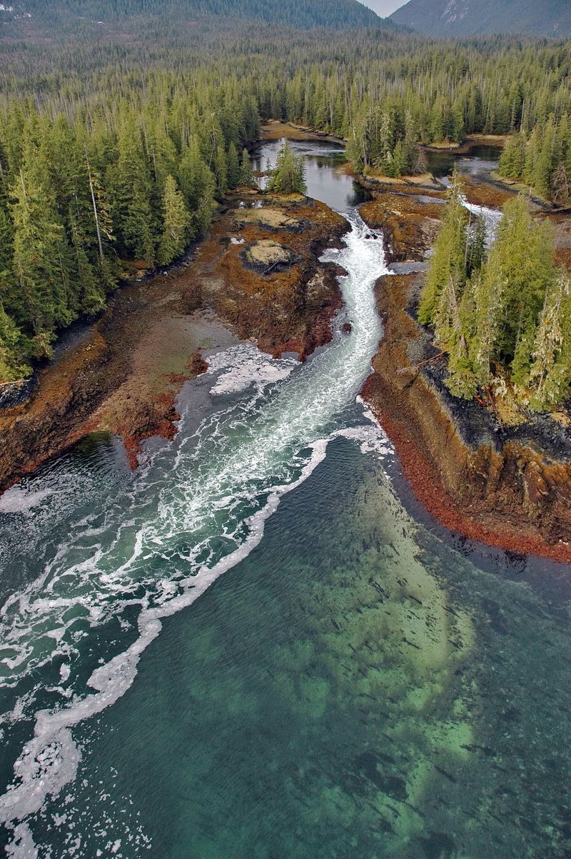
Some interesting info and photos of the coastline of Alaska in this link.
https://www.amusingplanet.com/2015/09/alaska-magnificent-coastline.html
https://www.amusingplanet.com/2015/09/alaska-magnificent-coastline.html
The project was developed in 1989 in order to access damage caused by the Exxon Valdez oil spill. Since then it has been used to gather habitat information of plants, animals and fishes, review applications for industrial permits, assess the risks posed by eroding shorelines and rising sea levels, and monitor the spread of invasive species and marine debris. These images along with useful data were long available to the public, but it’s the first time they are available on an interactive website, not unlike Google Earth.
The images themselves are some of the finest examples of scientific photography. Although shot primarily to help professionals manage the resources in this area of the planet, the exquisite colors, contours, and textures in these beautiful images can help us all appreciate the fragile environment that is slowly being destroyed by rising seas, increasing industrial development and human-made disasters.