

More HERE.
The U.S. state of Oregon has at least 19 lakes named “Lost Lake”, but possibly only one fits the name. This particular Lost Lake is located within the Willamette National Forest just outside the Mt. Jefferson Wilderness. The lake is also one of the best known because it is easily accessible — it lies adjacent to the heavily travelled Santiam Pass Highway, Oregon Highway 20.
Lost Lake was formed about 3,000 years ago when lava flowing from the Sand Mountain Line of small volcanoes blocked a river channel to create a small basin of water which now holds the lake. The lake begins to fill in the late fall, fed by several small surface streams, and continues to fill all winter in a series of rain or snowstorms. But as spring turns to summer and the streams dry off, the lake drains down a huge hole located on the lakebed. In particularly dry years, the entire lake disappears leaving a small meadow in its place.
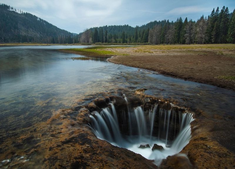
Photo credit
