You are using an out of date browser. It may not display this or other websites correctly.
You should upgrade or use an alternative browser.
You should upgrade or use an alternative browser.
The Great Lakes
- Thread starter FastTrax
- Start date
FastTrax
Well-known Member
Michigan was the go to state in 1950's, auto workers pay scale gave them life a life of luxury-as perceived by other states of the union.
They could afford to buy craft to frolic on the Great Lakes.
The two gas embargo, people had get rid of their american monster cars and buy Jap economic transportation
The muscle cars returned in latter 70's amd 80.s, this was crazy. The Middle East can turn off the oil supply at any time:;-we Have a Learning Problem in America!
(I've posted this before, in 1962 Texas Legislator had a bill presented: Raise minimum wage to $1.00 a hour.
I was working in a sweat shop, earning around 60-75 cents an hour. The dirt poor citizens of Texas were eagerly awaiting the results.
One worker stated, 'if we can get that $ 1.00 one dollar an hour, we'll be in high cotton.
This individual, made me reevaluate my further than any person in my life.)
However, the poor folks had NO political power to influence the legislator.
We were used to being poor, it was the way things had always been.
Enlightenment struck" Get out of this state, get education, don't just sit here -move!
Gosh, I've taken the OP South again, sorry
Spent 8 years in Michigan, Lake Huron is turly an awe inspiring sight. The bridge to Canada is arched, you go waaaaaaaay high, scared me..
Detroit population is now under 1 million-a disgrace.
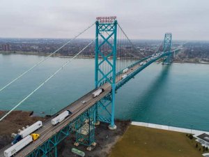

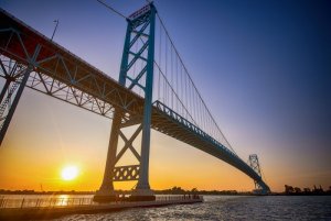
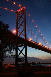
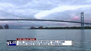
Hey jo I hope this is the right bridge. It's the only one that looks kinda bendy in the middle. If not let me know which one of the other's it is and I'll post it.
www.ambassadorbridge.com
www.ambassadorbridge.com/LiveCan/view.htm
www.npr.org/templates/story/story.php?storyId=10260623
BTW: The live cam seems not to be functioning in real time. The only way I can see the vehicles moving through the toll booths is to keep hitting autorefresh icon on the upper left of the screen.
https://en.wikipedia.org/wiki/Ambassador_Bridge
Last edited:
Robert59
Well-known Member
Lake Michigan Car Ferry - Lake Express - Traveling with Kids Vlog 3
Robert59
Well-known Member
Charming Mackinac Island Michigan: Frozen In History 4 K video
Robert59
Well-known Member
Cascades Falls Jackson, Michigan
Lewkat
Senior Member
- Location
- New Jersey, USA
I love all your Videos, FastTrax. Educating and entertaining. Thank you so much for posting these.
FastTrax
Well-known Member
I love all your Videos, FastTrax. Educating and entertaining. Thank you so much for posting these.
My pleasure Lewkat. I simply enjoy making my friends here happy. It truly makes my day. GOD Bless.
Aneeda72
Well-known Member
Lived in Wisconsin,1970, in my early twenties, lived right off the water. Would walk down to the small peer, throw in a line, walk down later for the fish. Free dinner. Town had maybe 30 houses if that many.
That first winter we got up to go to work, neither car would start as it was so cold. Moved.
That first winter we got up to go to work, neither car would start as it was so cold. Moved.
FastTrax
Well-known Member
Lived in Wisconsin,1970, in my early twenties, lived right off the water. Would walk down to the small peer, throw in a line, walk down later for the fish. Free dinner. Town had maybe 30 houses if that many.
That first winter we got up to go to work, neither car would start as it was so cold. Moved.
I found that little tidbit out when I relocated to Dutchess County. Had to park my car facing South in the winter.
Robert59
Well-known Member
Gentle Giants Visits Mackinac Island, Michigan
RadishRose
SF VIP
- Location
- Connecticut, USA
Robert59
Well-known Member
Kitch-Iti-Kipi "Big Springs" 45 foot deep pond thats crystal clear
This is Big Springs "Kitch-Iti-Kipi" in northern michigan. Its a 45 foot deep pond that you can see clear down to the bottom of. 10,000 Gallons of water per minute get pumped into the bottom of this spring from an underground natural spring. Its the largest natural spring in Michigan. Check out how the sand at the bottom looks like its boiling as the water rushes into the pond from underground. The dropoff is very steep almost straight down as you can see in the video. Its breathtaking and awesome to watch as another one of the beautiful wonders of Michigan.
This is Big Springs "Kitch-Iti-Kipi" in northern michigan. Its a 45 foot deep pond that you can see clear down to the bottom of. 10,000 Gallons of water per minute get pumped into the bottom of this spring from an underground natural spring. Its the largest natural spring in Michigan. Check out how the sand at the bottom looks like its boiling as the water rushes into the pond from underground. The dropoff is very steep almost straight down as you can see in the video. Its breathtaking and awesome to watch as another one of the beautiful wonders of Michigan.
Robert59
Well-known Member
Heavy Seas on Lake Superior
Camper6
Well-known Member
- Location
- Northwestern Ontario Canada
I'm disappointed in the map. Ports of call on the St.Lawrence Seaway. Ocean vessels go all the way into the center of North America to Thunder Bay Ontario and Duluth Minnesota. They pick up grain from the Western Provinces for Europe.The Largest Freshwater System In The World
View attachment 124750
View attachment 124751
View attachment 124752
View attachment 124753
View attachment 124754
www.greatlakes.org
www.mygreatlakes.org
www.glc.org
www.greatlakescruising.com
www.maritimehistoryofthegreatlakes.ca
www.greatlakesvessels.org
www.greatlakescircletour.org
https://ais.boatnerd.com
http://coastwatch.msu.edu
www.greatlakesbass.com/weather/
www.weather.gov/greatlakes/
https://greatlakes.coastguard.dodlive.mil
www.facebook.com/uscggreatlakes/
www.twitter.com/uscggreatlakes?lang=en
I remember crossing the straits of Mackinac by ferry and then the bridge. Scary. At first only grates you could see right down to the water on top of ships crossing. The Queen visited Thunder Bay when the Seaway opened on the Royal Yacht Brittanica all the way from England. Her husband was bored. Now he's boring.
Robert59
Well-known Member
Frozen Riverwalk Stunning Lake Michigan Iced Over 4K Drone Footage
horseless carriage
Well-known Member
What a fascinating and most enjoyable thread. North American history has long interested me, two notable events especially. The American civil war and the war of independence that culminated in the Treaty of Paris in 1783.
The US/Canadian border was set roughly along the 49th parallel, which meant that you had, in many places, a water border. Lake Superior is an example, shared by the United States and Canada. The international boundary splits the Lake from Sault Ste. Marie northwest around Isle Royale to the Pigeon River, then along a chain of lakes and the Rainy River to Angle Inlet in Lake of the Woods, where it forms Minnesota’s unique Northwest Angle before dropping to the 49th Parallel and on to the West Coast.
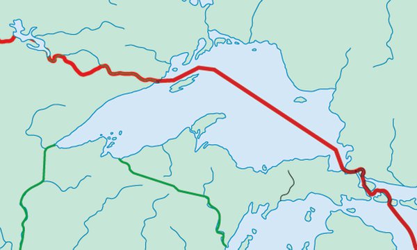
Why did Isle Royale, about 15 miles from the Canadian mainland, end up as part of the more distant United States? Mitchell’s map may help explain. If Lake Superior were as he drew it, it would have been more evenly divided than it is.
Seeing the ice in those videos explains much on our side of the pond. If you follow the 49th parallel across The Atlantic Ocean you will see that The British Isles are all completely north of the line, yet we never get winters like those on The Great Lakes.
The North Atlantic Current is a powerful, warm current within the Atlantic Ocean that laps our shores and keeps our winters relatively mild. Last night we needed some provisions from the freezer, we have a small freezer in the kitchen and a large one in the garage. Going to the garage and back my wife came in shivering, we are in a cold snap at the moment, but as I pointed out previously, it's relative. Follow the lines of latitude we share with Canada and on their side of the pond they have polar bears, to mention nothing about their winter heating bills.
The US/Canadian border was set roughly along the 49th parallel, which meant that you had, in many places, a water border. Lake Superior is an example, shared by the United States and Canada. The international boundary splits the Lake from Sault Ste. Marie northwest around Isle Royale to the Pigeon River, then along a chain of lakes and the Rainy River to Angle Inlet in Lake of the Woods, where it forms Minnesota’s unique Northwest Angle before dropping to the 49th Parallel and on to the West Coast.

Why did Isle Royale, about 15 miles from the Canadian mainland, end up as part of the more distant United States? Mitchell’s map may help explain. If Lake Superior were as he drew it, it would have been more evenly divided than it is.
Seeing the ice in those videos explains much on our side of the pond. If you follow the 49th parallel across The Atlantic Ocean you will see that The British Isles are all completely north of the line, yet we never get winters like those on The Great Lakes.
The North Atlantic Current is a powerful, warm current within the Atlantic Ocean that laps our shores and keeps our winters relatively mild. Last night we needed some provisions from the freezer, we have a small freezer in the kitchen and a large one in the garage. Going to the garage and back my wife came in shivering, we are in a cold snap at the moment, but as I pointed out previously, it's relative. Follow the lines of latitude we share with Canada and on their side of the pond they have polar bears, to mention nothing about their winter heating bills.
old medic
Senior Member
- Location
- Western NC
I have a book around here about the history of shipwrecks on the great lakes...
Very interesting read
Very interesting read

