

You are using an out of date browser. It may not display this or other websites correctly.
You should upgrade or use an alternative browser.
You should upgrade or use an alternative browser.
Wonderful World of Maps - "Knowing Where To Draw The Line"
- Thread starter Meanderer
- Start date


The American Civil War: Every Day
(note Sherman's march through Georgia and then up through the Carolinas, beginning around the 4:00 minute mark)
More detailed legend:
Dark Blue = United States of America and territories
Blue = Areas occupied by Union forces.
Light blue = Gains for that day
Maroon = Confederate States of America and territories
Red = Areas occupied by Confederate forces
Pink = Gains for that Day
Yellow = Border states / disputed areas.
RadishRose
Forever in Our Hearts
- Location
- Connecticut, USA
Nancy, this was very interesting! Thanks for sharing it.


How Far Did Armstrong Moon Walk? Mapping the Lunar Landing
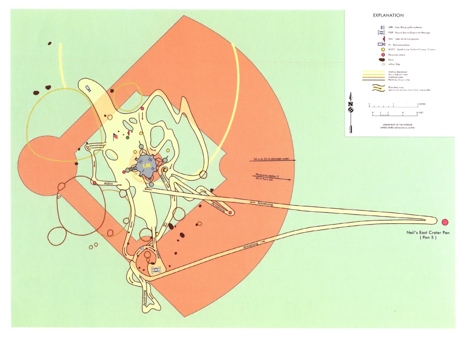
"On July 20, 1969, Commander Neil Armstrong and pilot Buzz Aldrin landed on the Moon. Six hours later on July 21, Armstrong stepped out of the lunar module Eagle and became the first human to walk on the moon. Aldrin joined him on the surface, but the two astronauts did not walk far during the span of more than two hours".
"This map shows the paths Armstrong and Aldrin walked on the surface of the Moon in comparison to the size of a baseball diamond. The map was created by historian Eric Jones and is featured in the book Strange Maps: An Atlas of Cartographic Curiosities by Frank Jacobs. The book is available from the Ball State University Libraries GIS Research and Map Collection (GRMC)".
“LM” on the map marks the location of the lunar module. Armstrong placed a television camera to the left of the module (between third base and home plate). And the yellow circles mark the location of surface cameras. The larger circles on the map identify craters of various depths".


Origin of term "Third World Countries"
"French demographer, anthropologist and historian Alfred Sauvy, in an article published in the French magazine L'Observateur, August 14, 1952, coined the term Third World (French: Tiers Monde), referring to countries that were unaligned with either the Communist Soviet bloc or the Capitalist NATO bloc during the Cold War".
"Third World countries referenced the nations, mostly in Asia and Africa, that were not aligned with either the United States or the Soviet Union, which are considered to be in the First World and Second World, respectively. Now that the Soviet Union no longer exists, the definition of "Third World" is not as precise and, thus, more open to interpretation".

The "three worlds" of the Cold War era, as of the period between April 1975 and August 1975.
First World: United States, United Kingdom and their allies.
Second World: Soviet Union, China, and their allies.
Third World: neutral and non-aligned countries.
"French demographer, anthropologist and historian Alfred Sauvy, in an article published in the French magazine L'Observateur, August 14, 1952, coined the term Third World (French: Tiers Monde), referring to countries that were unaligned with either the Communist Soviet bloc or the Capitalist NATO bloc during the Cold War".
"Third World countries referenced the nations, mostly in Asia and Africa, that were not aligned with either the United States or the Soviet Union, which are considered to be in the First World and Second World, respectively. Now that the Soviet Union no longer exists, the definition of "Third World" is not as precise and, thus, more open to interpretation".
The "three worlds" of the Cold War era, as of the period between April 1975 and August 1975.
First World: United States, United Kingdom and their allies.
Second World: Soviet Union, China, and their allies.
Third World: neutral and non-aligned countries.
jujube
SF VIP
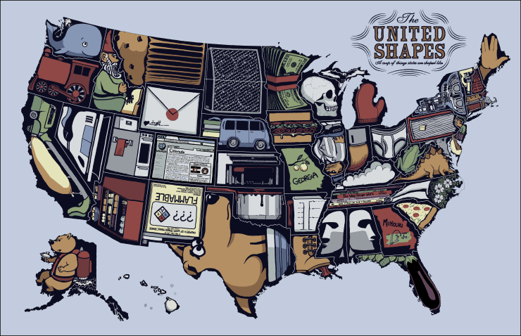
Most popular product per state:

